Friday

Gray Mountain, the highest point in the Peloncillo Mountains with the Portal Rodeo Hiking Club

The Portal Rodeo Hiking Club climbed Gray Mountain, the highest point in the Peloncillo Mountains, this week.  Access was through a locked gate on from the north but the maps show other roads from the west that might be accessible.  The route was up one draw and scree slope to a saddle and then staying on the ridge tops the group traversed to the peak of Gray Mountain.  The total round trip was between 5 and 6 miles depending upon the route and included 2000' of elevation gain.  While no trail exists, plenty of cattle paths make route finding easy.  The views from the top of Gray Mountain include the Chiricahua, Animas, Big and Little Hatchets, and the Florida Mountains.  The map of the hike is in the sidebar or here, and a 360 degree panorama from atop Gray Mountain is at Microsoft's Photosynth site.  At the top everyone broke for lunch and signed the register.  On the way down the group divided up and several hikers came down a drainage and intersected the road on the west side of the Peloncillos. This is a fun hike though some of the rarely seen Peloncillo Mountains.

Google Earth screenshot of route up Gray Mountain.

Pine Tree atop Gray Mountain.

A view of Portal Peak and the Chiricahua Mountains from the hike up Gray Mountain.

Sunday

Grouting the Bungalow

There are always projects at the Painted Pony Resort that require attention.  Recent activity centered around the bungalow.  The grouting in the bathroom needed attention and so after collecting materials work began.  First cleaning out the old grout around the sunken bath and along the edges.  Then adding new grout to the cleaned areas.  Some of the grouting around the walls and sinks also required replacement.  Since this was indoor work, Roadie did not help.

Bathtub grout

Floor grout

Friday

Pool Maintenance at the Painted Pony Resort

The 20' x 40' pool at the Painted Pony Resort is heated with a combination of geothermal and solar with a goal of 80 degrees in the pool.  A recent broken pipe has taken some time to repair but the pool is now ready for cleaning.  While shocking and vacuuming, Roadie the Roadrunner, came down to help with pool maintenance and as always was a thoughtful and helpful assistant. A mated pair of Roadrunners lives at the resort full time and frequently show up while working outside.  I suspect they show up in hopes some tasty bug will be uncovered for them but the company is always appreciated.

Roadie asking a question about pool water quality.

Roadie collecting a water sample for testing.

Tuesday

A New Historical Marker in the Bootheel

A new historical marker was approved by the New Mexico Scenic Historic Marker by the Cultural Properties Review Committee at its December 10 meeting in recognition of Rodeo's first airfield.  The Rodeo Intermediate Field was built in the late 1920's as part of the national intermediate field system, a system of emergency landing fields built along early commercial aviation routes in support of the growing aviation industry.  The route through the San Simon Valley and Rodeo was flown by Standard Airlines (later to become part of TWA) and included flights from Los Angeles and San Diego to El Paso.  During WWII the field became part of the Army Axillary field system and additional buildings were added.  The radio building from the airfield now sits in Rodeo and is part of Rodeo Cottages.  The history of this project may be found at The Sky Gypsies.


Big Red Arrow pointing to El Paso

Former Radio building in Rodeo, New Mexico
 

Friday

Hummingbird Spring in the Chiricahua Mountains with the Portal Rodeo Hiking Club

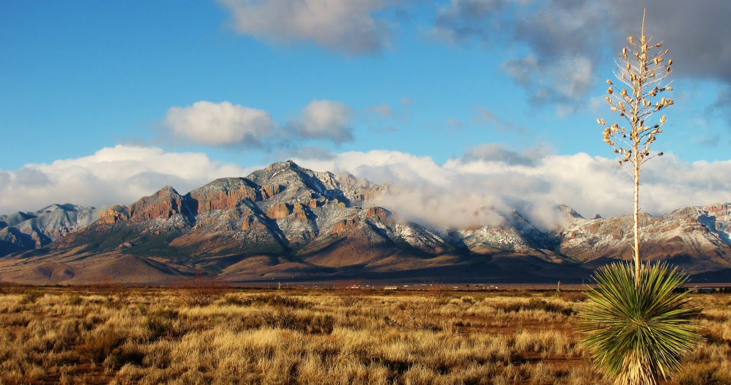
The hike this week with the Portal Rodeo Hiking Club to Hummingbird Spring on the east face of the Chiricahua Mountains just outside Portal, Arizona was spectacular. It was lead by Peg Abbot owner and lead guide of Naturalist Journeys who was kind enough to start the trip with coffee cake and lots of hot coffee for everyone.  Access to the trail leading to Hummingbird Spring is across a small section of private land along a public access route (close the gate) on Starview Place just south of Portal Road.  The trail then wraps around the low rhyolite and limestone foothills, slowly climbing the face of the Chiricahua's until reaching Humminbird Spring.  The spring is located further uphill but a pipe delivers the dripping water to a cement trough which the dogs were happy to play in.  The loop shown on the 
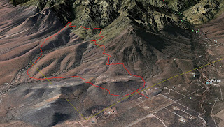
Hummingbird Spring map (or in the sidebar) covered about 6 miles and included a maximum elevation change of 1000'.  Shorter or longer hikes are easily created from the numerous trails in the area.  In fact the group broke up along the hike with some returning after reaching Hummingbird Spring and then later the group again split with several hikers continuing south climbing another ridge to view the San Simon valley before looping back and hiking out.  The geology at the contact between the limestone and rhyolite is quite interesting.  Faulting is evident in many places (see this photograph) and the zone of mineralization is evidenced by several test pits and at least one abandoned mine shaft.

Trail to Hummingbird Spring

I want some too.

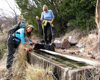
Not a Hummingbird in Hummingbird Spring

Tuesday

Standing Stones in Skeleton Canyon

Skeleton Canyon which straddles the New Mexico Arizona border in the bootheel was one of the most scenic hikes made with the Portal Rodeo Hiking Club and the opportunity to post another photograph from the hike was to much to bear. The photographic opportunities in the canyon seemed endless and the hiking easy. Below is an image I captured while climbing a ridge toward the back of the canyon. A series of large volcanic tuff blocks are spaced at regular intervals along the side of the ridge, appear as sentinels guarding the canyon below. They resemble the megalithic standing stones found throughout Europe which was the impetus for the photograph and the soft cloud formations above juxtapose nicely with the angular volcanic tuff blocks.  A map of the hiking route may be found on Google maps.

Standing Stones in Skeleton Canyon

Saturday

Christmas Bird Count

The National Audubon Societies annual Christmas Bird Count is underway.  Today, the bird census is taking place in the Chiricahua Mountains and tomorrow the Peloncillo Mountains will be the target of the census.  There are a number of visitors in the area helping with the yearly count.  Cave Creek Ranch has more details.